萨斯喀彻温省上空的乳状云
(原标题: Mammatus Clouds over Saskatchewan)
2021-08-11
浏览次数: 589
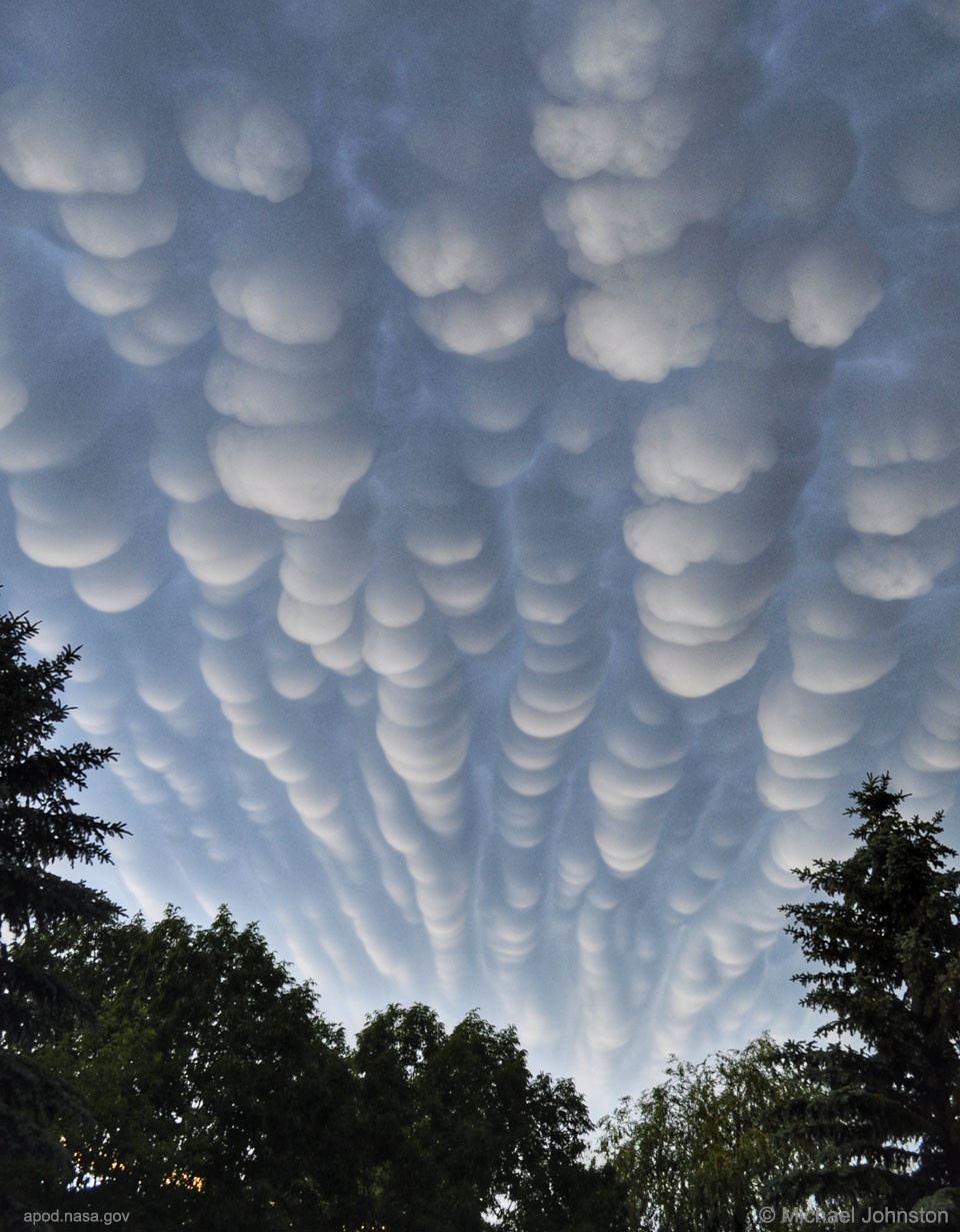
什么时候云底会像泡沫一样出现?通常,云底是平的。这是因为潮湿的暖空气上升和冷却后会在特定的温度下凝结成水滴,这通常对应于一个非常特定的高度。随着水滴的增长,不透明的云就形成了。然而,在某些条件下,云袋可以形成,其中包含大水滴或冰,当它们蒸发时落入清澈的空气中。这种小袋可能出现在雷暴附近的湍流空气中。由此产生的乳状云如果从侧面照射,会显得特别引人注目。2012年,在加拿大萨斯喀彻温省的里贾纳,一场暴风雨刚刚结束,照片上的乳状云只持续了几分钟。今晚的流星雨:英仙座流星雨的高峰期
查看原文解释
When do cloud bottoms appear like bubbles? Normally, cloud bottoms are flat. This is because moist warm air that rises and cools will condense into water droplets at a specific temperature, which usually corresponds to a very specific height. As water droplets grow, an opaque cloud forms. Under some conditions, however, cloud pockets can develop that contain large droplets of water or ice that fall into clear air as they evaporate. Such pockets may occur in turbulent air near a thunderstorm. Resulting mammatus clouds can appear especially dramatic if sunlit from the side. The mammatus clouds pictured here, lasting only a few minutes, were photographed over Regina, Saskatchewan, Canada, just after a storm in 2012. Meteor Shower Tonight: Peak of the Perseids
© Michael F Johnston